But back to hectares, if you're interested. A hectare is 10,000 square meters. If you're American, that still may not help you. One hectare is about 2.47 acres. Now it is all starting to make sense. But whether you think in acres or hectares, Urupukapuka is still a pretty big island. And we had one of the best walks we've ever had in New Zealand there. It is full of archaeology, lots of varied scenery and great views. What's not to love.
Our starting point was Paradise Bay. We were the only boat in the anchorage that day - this rarely happens to us in New Zealand. And it's one of the reasons why I chose Paradise Bay as one of my favorite anchorages in New Zealand in this post here. Solitude can be a lovely thing.

From Paradise Bay, we picked up the southern side of the Paradise Bay loop. You can see it on the map below. The trails are color coded so that you know what you're getting into - green is easier, red is medium and yellow is steeper. If you do the whole thing, it is supposed to take around five hours. We concentrated on the northern part of the island and were mostly yellow walkers, with a touch of red.
 |
| Via Department of Conservation |
There I am - way in the distance. I'm going to have to start wearing brightly colored clothing so Scott can keep track of me.

On the northern side of the island, you get more rugged cliffs. I'm always happy when they have stairs. It makes things so much easier.


Scott likes to take pictures looking down from cliffs. Which is fine except he gets right to the edge of the cliff. This makes me very nervous and I keep telling him to move back. This of course causes him to inch forward. You can see why I race ahead of him on our walks. I can't stand watching him almost tumble down the side of a cliff just for the sake of a picture.

Next we picked up the Pa Loop track. This is where a lot of the 66 archaeological sites on the island can be found. The Maori occupied the island long before the Europeans showed up. The island is chock full of history - you can read more about it at the Department of Conservation website here. There are a lot of signs which explain what you're seeing.

The signs are helpful because otherwise, you might not realize that you're walking past an archaeological site. Would you know what this depression was if the sign didn't tell you?

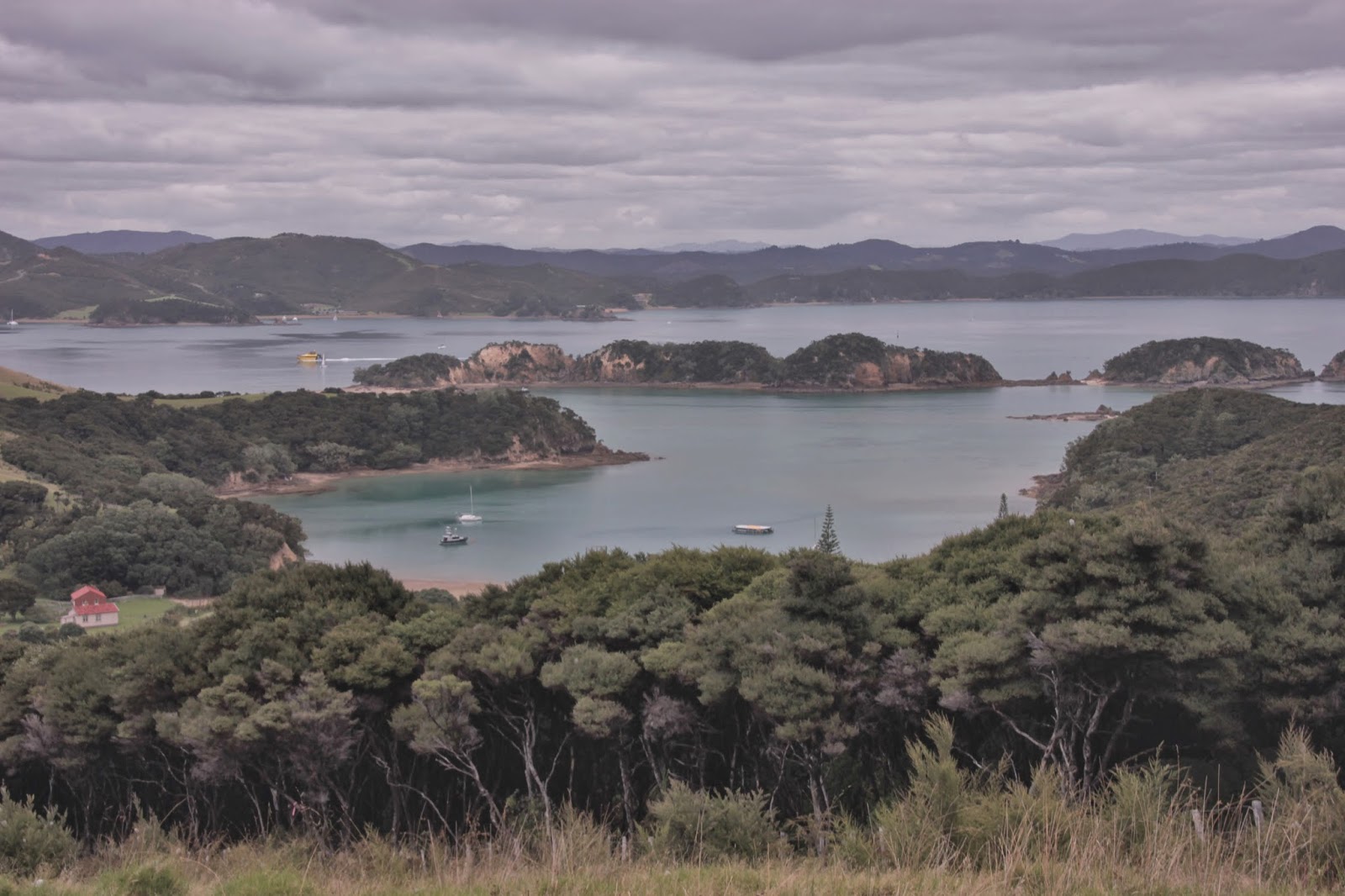
This is the Akeake Peninsula. We walked along it and checked out the beach.

And some random trivia before I leave you with a final photo - Zane Gray used the Otehei Bay as a base for game fishing which made it popular with the rich and famous.
Walk on Sunday, 2 March 2014
Pretty pictures Ellen! I learned via the metric system, and now inches and feet and races are all very confusing to me :)
ReplyDeleteThanks Sarah - you're young and have one of those flexible brains that can learn things like metric :-) Do your parents still think in terms of inches and feet or are they more clever than me and have adapted to metric?
ReplyDeleteOh interesting! That looks like a great workout with awesome views! Thanks for teaching us about hectares! Haha I never knew about that. Hope to visit New Zealand one day!
ReplyDeleteThanks for stopping by the blog! That is one think I like about hiking in NZ - you get some exercise and great views!
DeleteAbsolutely gorgeous. I would love to walk on an island like this - or even sail to one!
ReplyDeleteWe feel very fortunate to have had the opportunity to sail and visit islands like this. Urupukapuka was truly spectacular!
Delete